
Local Column
COLUMN
How to get to and play at the Fuki-togawa River, a sightseeing spot in Ishigaki Island! Ishigaki Island resident staff will give you a thorough explanation!
Hello everyone!
When people think of Ishigaki Island—Japan’s No. 1 resort destination—they’re likely to picture its striking blue ocean and white-sand beaches, and it’s often strongly associated with marine activities. However, Ishigaki Island’s attractions aren’t limited to the ocean; its rivers and mountains are also full of charm. In particular, the island’s rivers are lined with mangrove forests—a characteristic feature of the subtropical climate—creating a truly atmospheric setting.
The Fukidori River on Ishigaki Island is home to the ”Matchmaking Falls,” a power spot for romance. River activities are also very popular here, and since the area is currently booming in popularity, it’s definitely worth checking out.
In this article, we’ll introduce the Fukitsugi River.
Table of Contents
What Is the Fukidori River?
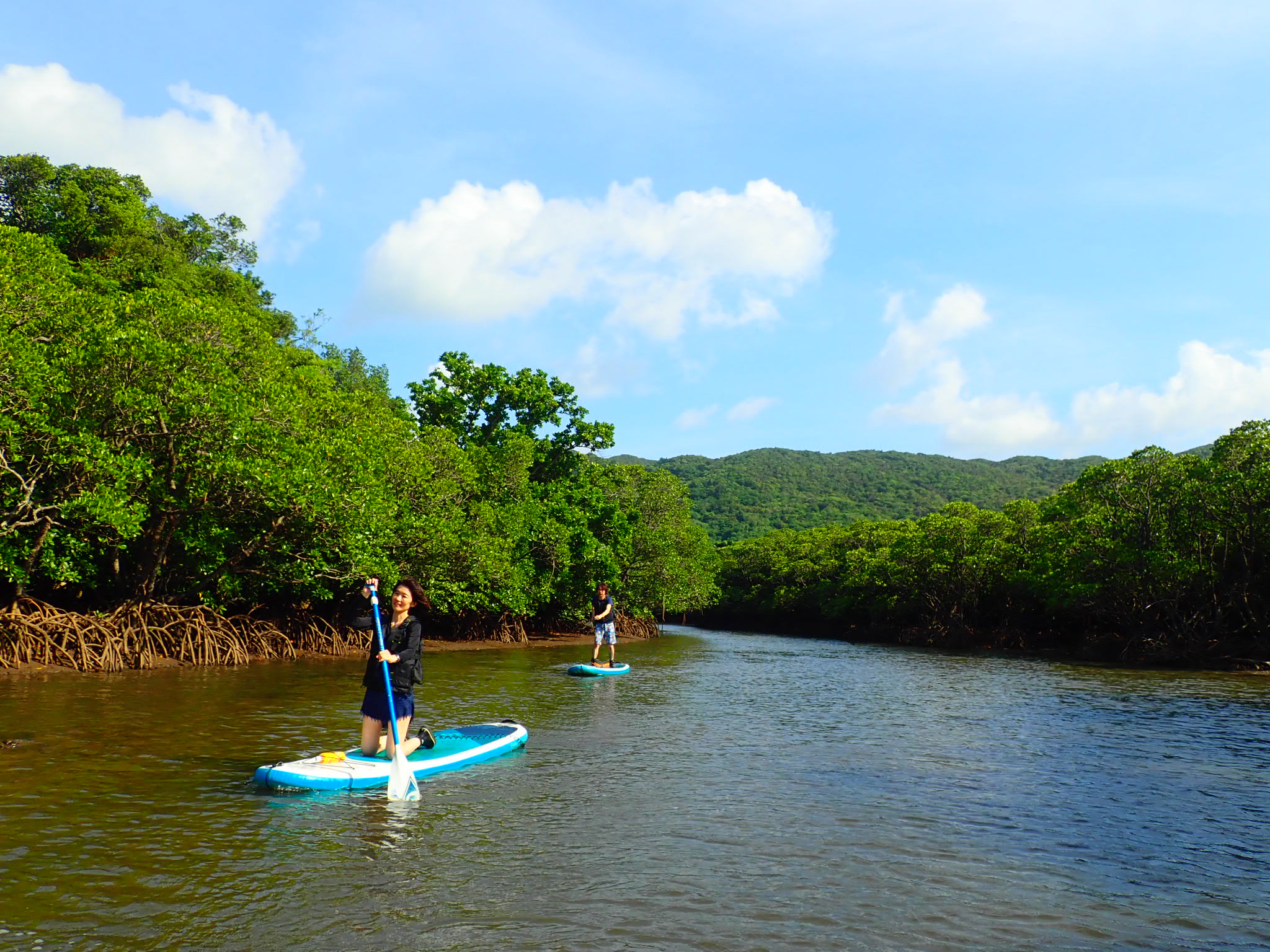
The Fukidori River is located about a 40-minute drive from the Ishigaki Island Port Remote Islands Terminal and is home to a dense stand of mangrove forests designated as a National Natural Monument.
There are two famous rivers on Ishigaki Island that are often used for recreational activities: the Miyara River and the Fuki-tō River. Here, we’ll introduce the latter.
Although the Fukidori River is a relatively small river compared to the Miyaura River—which boasts the largest watershed on the island—it is easily accessible from the mouth all the way upstream, making it one of the most popular spots for enjoying the changes in flora and fauna as you move through different sections of the watershed.
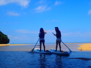
Since there are mudflats in addition to mangroves, it’s the perfect environment for experiencing a diverse range of wildlife. To head upstream, you’ll mainlySUPand ... andcanoe...will be used. We'll go over the details in the "How to Enjoy the Fukitsugi River" section.
How to Get to the Fukidori River
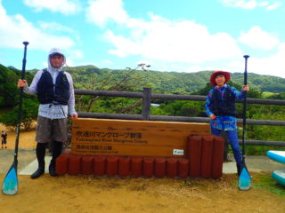
The Fukidori River flows through the Hirakubo Peninsula, which juts out from the northeastern part of Ishigaki Island. As a result, it is located near Itona Beach, north of Prefectural Route 79.
Just before the bridge over the Fukidori River, on the right-hand side, there is a free parking lot called Fukidori Bridge Parking Lot. From the parking lot, there are stairs leading to the mangrove grove, and if you walk down them, you can enter the river.
At low tide, you can see the distinctive roots of the mangroves, so be sure to check the tide table and take a leisurely stroll.
Detailed Information on the Fukidori River
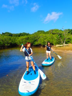
The Fuki-tō River, which originates at Mt. Nosoko, is approximately 2.2 km long; in the estuary—where the river mixes with seawater—mangrove forests thrive.
"Mangrove" is a general term for plants that grow in brackish water areas—such as estuarine wetlands and coastal mudflats in tropical and subtropical climates—that are affected by tidal fluctuations; it does not refer to any specific plant. Therefore, there are, of course, various species within the mangrove group.
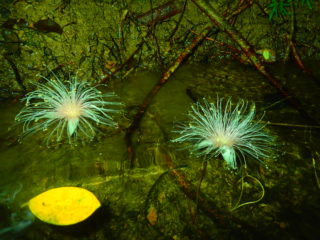
Plants of the Rhizophora genus, which are designated as Natural Monuments, are commonly seen along the Fukidori River. Colonies consist mainly of Rhizophora mucronata and Rhizophora yaeyamae.
The sandbars and cliffs formed by the tides are home to a rich variety of plant life.
While mangroves serve as hiding places for fish and crabs, they also provide the habitat necessary for birds to breed and grow, thereby supporting not only aquatic but also terrestrial ecosystems.
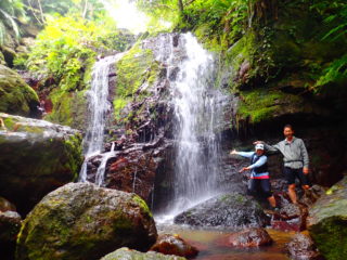
Because the Fukidori River is close to the ocean, many of the aquatic creatures that live here—such as shrimp, fish, and crabs—move back and forth between the ocean and the river. Since this activity takes you from the ocean side into the river mouth and upstream, you might be able to observe these creatures as they move along during the activity.trekkingLet's enjoy the
How to Enjoy the Fukidori River
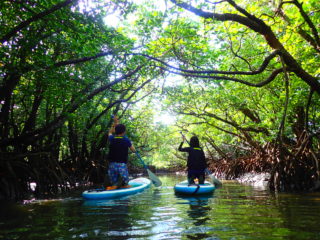
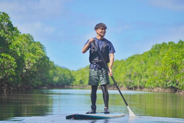
As I mentioned briefly above, the Fuki-tō River is our main venue, and our main activities are SUP and river kayaking.
Starting from the crystal-clear waters off Ishigaki Island, we head upstream toward the river mouth. As we move upstream, we encounter different creatures than the fish we saw in the ocean. In particular, the types of plants forming the mangrove communities change, making for a visually enjoyable experience.
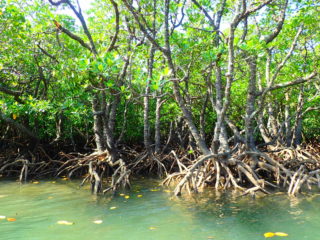
There are various types of mangroves here, such as the Yaeyama mangrove, which resembles a raised platform with its tentacle-like roots extending outward; the Ohirugi, whose knee-like roots protrude from the water; and the Mehirugi, which has slender branches and produces beautiful flowers. It’s a great idea to observe them during your SUP or kayak cruise and check with your guide to identify the different mangrove species. In addition to the plants, you can witness charming scenes on the mudflats, such as fiddler crabs inviting the tide in and gobies hopping about.
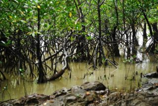
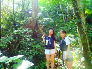
Once you arrive at the upper reaches, you'll go on a hike deep into the backcountry to ”Yabiku Falls,” also known as the "Matchmaking Falls."
Yabiku Falls isn’t a very tall waterfall, so you can safely play in the pool at the base. Even if you spend a little time playing there and then return to the starting point, the round trip takes only about two hours, so it’s recommended for those who want to try a short activity or who aren’t confident in their stamina but would still like to take a cruise on Ishigaki Island’s mangrove river.
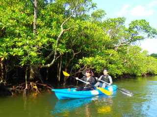
During the winter, strong north winds often cause marine activities to be canceled, but river activities on Ishigaki Island can be enjoyed without any problems because the mangroves act as windbreaks and breakwaters.
It might be a good idea to choose your activities based on the weather conditions.
Address: 1215-1 Nosoko, Ishigaki City, Okinawa Prefecture
Directions: About a 20-minute drive from New Ishigaki Airport; about 35 minutes from the Ishigaki Port Remote Islands Terminal
Phone number: 0980-82-1535 (Ishigaki City Hall Tourism and Culture Division)
Free Parking: Available (Fukidori Bridge Parking Lot)
Usage Fee: Free
Click here for a list of activities related to the Fukidori River
summary
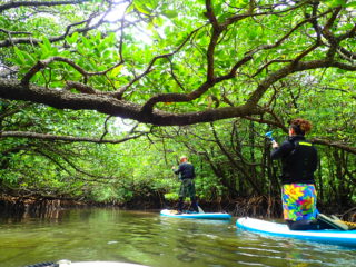
We’ve introduced you to the Fukidori River. What did you think?
The Fukidori River was a very atmospheric river with a high level of biodiversity, surrounded by mangroves typical of a subtropical climate.
The fishing spots along the Fukidori River are as follows:
・Since this is a brackish water area, you can enjoy observing how the types of mangroves change in response to fluctuations in salinity.
・Exciting outdoor activities like SUP and river kayaking
Activities can be held even in winter when north winds are strong.
・”Yabiku Falls,” the Waterfall of Matchmaking”
Please keep the above points in mind and visit the Fukidori River.
Thank you for reading to the end.
This article was written by.