Local Column
COLUMN
How to get to and play at Sokobaru Dam! Ishigaki Island resident staff explains thoroughly how to get there and how to play!
Hello everyone! There are five dams on Ishigaki Island: Nagura, Ishigaki, Sokobaru, Oura, and Maesato.
Among them, Sokobaru Dam is the largest dam in Ishigaki Island, and water from the dam is used for irrigation.
This article introduces the Sokobaru Dam.
Table of Contents
What is Sokobaru Dam?
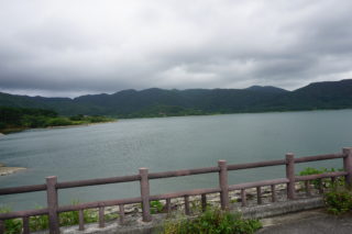
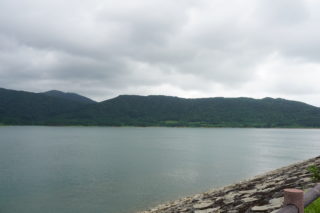
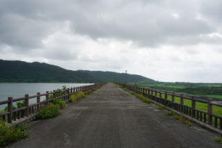
Sokobaru Dam is located in the center of Ishigaki Island, and is the largest rockfill dam on the island with an embankment height of 29.5m, a crest length of 1,331m, and a crest width of 8.0m, which is very long and wide. It was built to irrigate the Sokobaru River, a part of the Miyara River system that flows through the central part of Ishigaki Island. It is known as the longest rock-fill dam for agriculture in Japan. The promenade around the dam lake is beautifully maintained and you can take a leisurely stroll.
Directions to Sokobaru Dam
Sokobaru Dam is located in the middle of the island and is only 10 minutes from the airport.
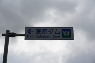
From Shin-Ishigaki Airport, head west on Route 211, turn right on Route 209, and then go straight on Route 87. Keep going and you will see a dam on your right.
More information about Sokobaru Dam
Sokobaru Dam is the largest of the five dams on Ishigaki Island. It is a rock-fill dam for irrigation built on the Sokobaru River in the Miyara River system located in the central part of Ishigaki Island. 1971, a severe drought occurred in Ishigaki Island and agriculture was severely damaged. Therefore, Sokobaru Dam was constructed to have water available at any time during the drought.
The subtropical climate of the island means that although annual precipitation is high, it is mostly due to the rainy season and typhoon season, and the water supply to agriculture was very unstable due to the lack of regular rainfall. Therefore, the Sokobaru Dam and water distribution ponds have contributed to the agriculture of Ishigaki Island since they were constructed.
How to play Sokobaru Dam
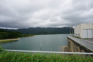
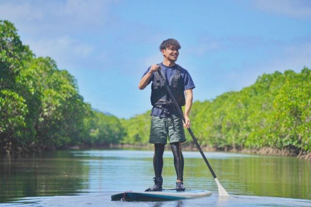
The Sokobaru Dam is surrounded by a promenade so that visitors can enjoy time relaxing while taking in the largest view of the island.
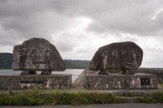
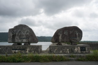
Near the Sokobaru Dam, there is also the Maesato Dam, and if you continue on to the back of the Maesato Dam, you will find the Omoto Tunnel, which is the longest tunnel in the Yaeyama area. It might be fun to visit these places. It may also be fun to simply look around the dam. As you may know, dam cards are distributed at dams on Ishigaki Island to commemorate your visit. On weekdays, they are distributed at the dam management office, and on weekends, they are distributed at the Yaeyama Peace Memorial Hall in Ishigaki City.
It may be difficult to get an image of what a dam card is, so I will give a brief explanation. A dam card is a pamphlet about a dam in card form that is managed, produced, and distributed by the Ministry of Land, Infrastructure, Transport and Tourism and the Japan Water Agency. Since it is a pamphlet, when you open it, it contains information about the dam. These are now distributed as part of public relations activities for dams. In fact, they have become so popular that 22 dam cards have been distributed in Okinawa Prefecture and 555 nationwide. There are even dam lovers who travel around the country collecting dam cards.
In order to get a dam card, you need to go to the dam management office or Ishigakijima City Hall. Although each dam may have its own conditions, there are some common principles regarding the distribution of dam cards, which are introduced below.
(2) Dam cards are not accepted by mail or courier service.
(iii) Dam cards will be distributed only at designated locations.
(4) Oura and Ishigaki Dam card distribution requires a photo or other proof of visit to the dam (*1 and *2 below).
*1Presentation of a photo taken of the dam by the dam card distribution applicant, etc.
*2 Images published on the Internet are not acceptable for distribution.
Address: Aza Miyara, Ishigaki City, Okinawa, Japan
Access: 20 minutes by car from the Remote Island Terminal, 10 minutes by car from Shin-Ishigaki Airport
Phone number: 0980-82-1794
River: Miyara River System Sukuhara River
Launched: 1975
Completed: 1992
Purpose: Irrigation
Format: Rockfill
Embankment height: 29.5m
Length of levee crest: 1,331m
Total water storage capacity: 13,000,000 m3
Effective water storage capacity: 12,850,000 m3
Watershed: 9 km2
Waterlogged area: 138 ha
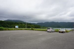
Parking: None
Restaurant: None
Toilet: None
Sokobaru Dam card:
Sokobaru Dam Management Office: 0980-82-1791
Inquiries: Weekdays 9:00-17:00 (except Saturdays, Sundays, and holidays)
summary
We have introduced the Sokobaru Dam. How was it?
The Sokobaru Dam, the largest dam on Ishigaki Island, was the savior of irrigated agriculture on Ishigaki Island, wasn't it?
The following are recommendations for such a Sokobara Dam.
Saving Agriculture from Drought
Well-maintained promenade
Dam card collection
Easy access from the airport
Please check the above and visit Sokobaru Dam.
Thank you for reading to the end.
This article was written by.