
Local Column
COLUMN
How to get to and play at Maesato Dam, a sightseeing spot on Ishigaki Island!
Hello everyone!
There are five dams on Ishigaki Island, which have various aspects of lifelines such as irrigation dams and water supply dams that support the agriculture of Ishigaki Island. Among them, Maesato Dam is the southernmost dam in Japan that is a multi-purpose dam for irrigation, flood control, and water supply. This article introduces the Maesato Dam.
Table of Contents
What is Maesato Dam?
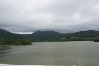
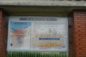
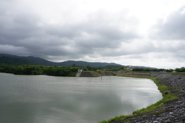
Maesato Dam is the southernmost dam in Japan, built on the main stream of Miyara River system, the largest river in the island, located in the central part of Ishigaki Island. It is a dam built for irrigation, flood control, and water supply, and literally supports the lifeline of Ishigaki Island. It was built together with Sokobaru Dam as part of Miyara River Land Improvement Project, and supplies water for waterworks as unspecified water.
Directions to Maesato Dam
From Shin-Ishigakijima Airport, take Prefectural Road No. 87 or No. 209 and go north for a while, and you will see the entrance to Omotodake on your right. Near this entrance, you will see a sign for Maesato Dam.
Detailed information on Maesato Dam
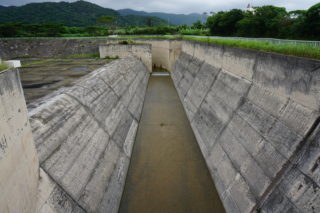
Maesato Dam is a dam constructed upstream of the Miyara River, a second class river originating from Omotodake, the highest peak in Okinawa Prefecture. The Miyara River, with its mangrove forests, is loved by the islanders, but it causes extensive damage when flooding occurs during times of high water and is subject to water starvation during times of drought, making it necessary to revive flood control and irrigation/drainage projects. Therefore, the Maesato Dam was constructed as a multi-purpose dam for irrigation, flood control, and water supply. This earth type multi-purpose dam (irrigation, flood control, and waterworks) is the only one of its kind in Ishigaki Island and is very useful. Although it is a multi-purpose dam, the supply of tap water seems to be prioritized.
How to play at Maesato Dam
Dam cards are distributed at dams on Ishigaki Island including Maesato Dam. The dam card is a pamphlet of dams in a card format managed, created, and distributed by the Ministry of Land, Infrastructure, Transport and Tourism and the Japan Water Agency. Since it is a pamphlet, when opened, it contains information about the dam. They are also distributed as a public relations tool for dams. In fact, they have become so popular that 22 dam cards have been distributed in Okinawa Prefecture and 555 nationwide. There are even dam lovers who travel around the country collecting dam cards.
In order to get a dam card, you need to go to the dam management office or Ishigakijima City Hall. Although each dam may have its own conditions, there are some common principles regarding the distribution of dam cards, which are introduced below.
(2) Dam cards are not accepted by mail or courier service.
(iii) Dam cards will be distributed only at designated locations.
(4) Oura and Ishigaki Dam card distribution requires a photo or other proof of visit to the dam (*1 and *2 below).
*1Presentation of a photo taken of the dam by the dam card distribution applicant, etc.
*2 Images published on the Internet are not acceptable for distribution.
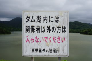
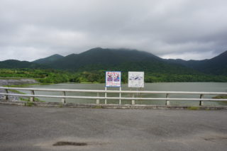
While collecting dam cards is one of the most enjoyable parts of visiting the dam on Ishigaki Island, walking around the Maesato Dam is also a fun way to enjoy the dam. On the other side of Maesato Dam, there is Sokobaru Dam. Beyond that is the Omoto Tunnel, the longest tunnel in Yaeyama with a total length of 1,174 meters. After passing through this tunnel, you will find tourist attractions such as the Blue Cave and the Yaeyama palm colony in Yonehara.
Ao no cave is a very beautiful and popular tourist spot, comparable to Kabira Bay. The Blue Cave is a cave in the sea, and is popular for its fantastic blue glow caused by the incidental sunlight and reflections from the seafloor. Surrounded by a wide variety of coral and colorful tropical fish, the cave is also a popular destination for activities. This is why there are so many activities here. When you visit the Maesato Dam, be sure to stop by.
Address: Aza Ohama Bunadahara, Ishigaki City, Okinawa, Japan
Access: 15 minutes by car from Shin-Ishigaki Airport, 20 minutes by car from the remote island terminal
Parking: None
Restaurant: None
Toilet: None
River: Miyara River System Miyara River
Launched: 1972
Completed: 1982
Purpose: irrigation, flood control, water supply
Format: Uniform grounding
Embankment height: 27.0m
Length of embankment crest: 367.4m
Total water storage capacity: 2,300,000 m3
Effective water storage capacity: 2,100,000 m3
Watershed: 4.82 km2
Waterlogged area: 25.5 ha
Maesato Dam card:
Maesato Dam Management Office: 0980-83-0233
Yaeyama Civil Engineering Office, River City Port Group: 0980-82-3262
summary
We introduced the Maesato Dam. How was it? Maesato Dam is a multi-purpose dam constructed on the Miyara River at the edge of the island to provide irrigation, flood control, and water supply. The Maesato Dam is recommended as follows.
Multi-purpose dam for irrigation, flood control, and water supply
Construction on Miyara River, the largest river in Ishigaki Island
Dam card collection
Easy access from the airport
Popular tourist spots such as the Blue Cave and Yaeyama palm colony
Please check the above and visit the Maesato Dam.
Thank you for reading to the end.
This article was written by.